
Camposol Mazarron Map: The Ultimate Guide to Sectors & Amenities
The Camposol urbanisation, located in the municipality of Mazarrón (Murcia), is one of the largest residential developments for expats and holidaymakers in the Costa Cálida. Due to its massive size, navigating its grid of streets can be challenging for first-time visitors and new residents.
If you are trying to find a specific villa, commercial area, or golf course, having a clear Camposol Mazarron map and understanding how the development is structured is essential. In this guide, we break down the different sectors, key amenities, and how to get there smoothly.
Understanding the Camposol Sectors (A, B, C & D)
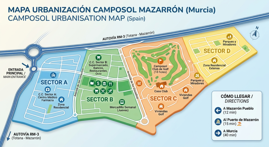
Camposol is split into four distinct zones, known locally as Sectors. Each sector has its own character, layout, and purpose:
- Sector A: This is the original part of the urbanisation and serves as the main entrance from the RM-3 motorway. It features a commercial centre with a medical centre, pharmacy, local shops, petrol station, and several bars and restaurants.
- Sector B: The largest commercial hub of Camposol. If you are looking for large supermarkets, banks, dental clinics, or a vibrant nightlife scene with plenty of international restaurants and pubs, this is where the map will lead you.
- Sector C: A quieter, predominantly residential area. Its main landmark is the Camposol Club de Golf, an 18-hole golf course that attracts enthusiasts from all over the region, complete with a popular clubhouse.
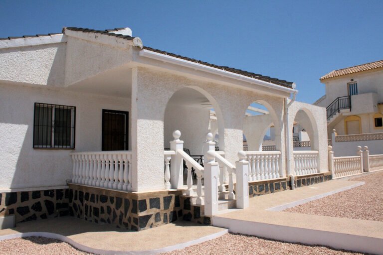
- Sector D: The largest and most spread-out residential sector. It is purely residential, offering peace and privacy, making it a favorite for long-term retirees looking for a quiet lifestyle.
🗺️ Live Interactive Map of Camposol
Use this live digital map to navigate between sectors, locate roundabouts, and get real-time GPS driving directions on your mobile phone:
How to Get to Camposol: Driving Directions
Camposol is exceptionally well-connected to the rest of the Murcia region via the RM-3 motorway (Totana-Mazarrón).
🚗 Key Distances & Travel Times from Camposol
Thanks to its strategic location right off the RM-3, commuting to nearby towns and beaches is straightforward:
- Camposol to Mazarron Town: 12 minutes by car (12 km).
- Camposol to Puerto de Mazarron (Beaches): 15-18 minutes by car (18 km).
- Camposol to Murcia International Airport (Corvera): Approximately 40 minutes via the RM-2 and A-30.
- Camposol to Alicante Airport: Around 1 hour and 20 minutes via the A-7 toll-free highway.
Frequently Asked Questions (FAQs)
Are all the sectors connected in Camposol?
Yes, all sectors are connected via internal roads and roundabouts. However, due to its scale, driving or cycling is highly recommended to travel between Sector A/B and Sectors C/D.
Where is the best place to park in Camposol?
Both Commercial Centres (Sector A and Sector B) offer large, free, open-air parking lots. Finding a parking space is generally easy, though it can get busier during summer mornings and weekend evenings.
Is there public transport available on the Camposol map?
There are regional bus routes connecting Camposol with Mazarrón town, Puerto de Mazarrón, and Murcia city. Local taxi services are also readily available, with dedicated ranks located near the Sector B commercial area.
📰 More Information About the Urbanisation:
To stay up to date with the latest local news, upcoming events, and community updates, check out the dedicated section for Camposol on Mazarrón Online.
Conclusion
Whether you are visiting for a golfing weekend, viewing properties, or moving permanently, understanding the Camposol Mazarron map ensures a stress-free experience. Familiarizing yourself with the distinct characteristics of Sectors A, B, C, and D will help you quickly locate the services, restaurants, or residential streets you need.
Are you looking for a specific street or business on Camposol? Let us know in the comments section below, and our community will help you find it!